| Version 21 (modified by , 15 years ago) ( diff ) |
|---|
User Guidelines - Incident Reporting
Summary
Purpose:
- This module is mainly used for uploading the disaster status that occured in your Locality.
- You can also upload the latest images of the disaster.
- you can also know the severity of the disaster.
Data
Types of Information:
- Reporting Incidence.
- Person Reporting.
- Location of Incident.
- GPS latitude and longitude Conversions.
Features
- A basic working System is operational on Demo
- You can view the List of incidents.
- You can view map.
- You have to be Logged in before doing below steps.
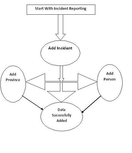
- You can add new incident and link it to the locations.
- You can also add person if he is victim too.
- You can add new Province.
Incident:
- Incident is a confirmed incident (for which there may be many reports received since reporters won't know about each others' reports)
Assessment:
- An assessment is a follow-up visit to an incident to get more details
1. Report an incident
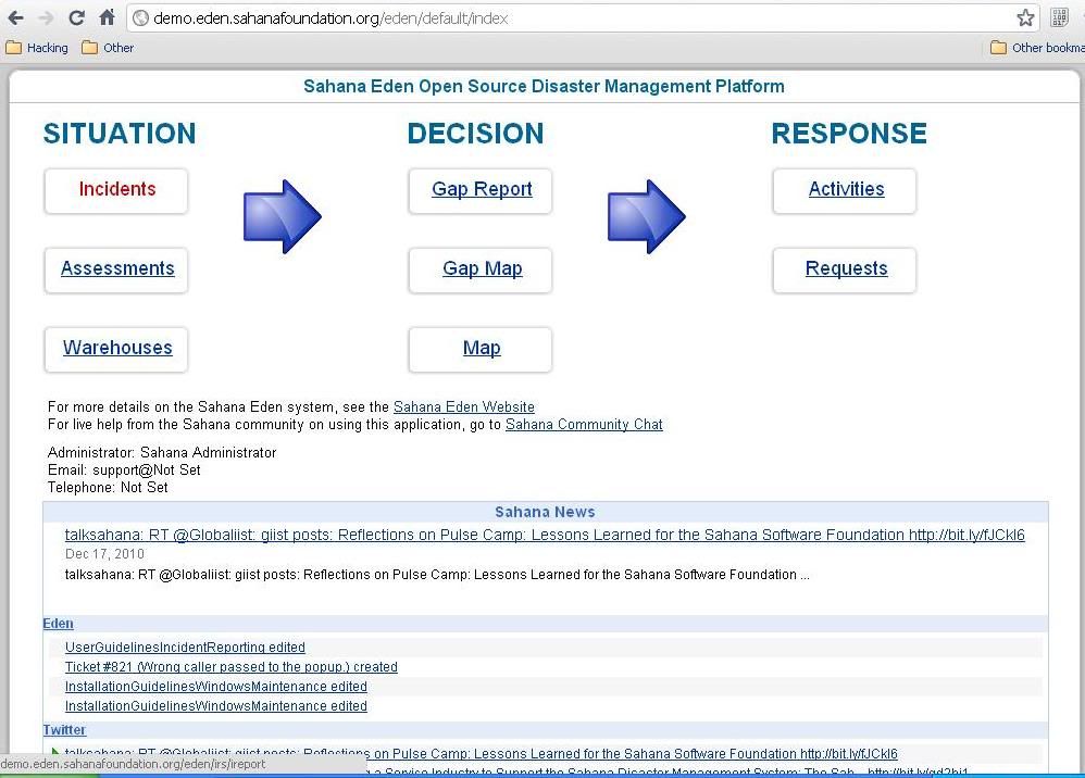
- Click "Incident Reporting" button on the top menu and link to the main page of this module.
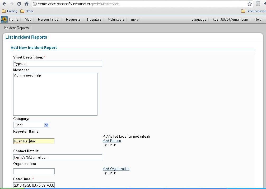
- Click "Add Report".
- Fill in the incident information and short description is required.
- Click "Save".
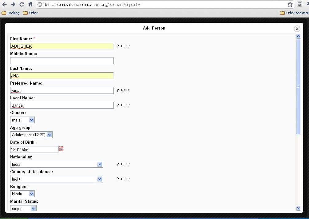
2. Add Person during reporting
- If the reporter is not the recorder, then "Add Person" is nessary.Especial when the reporter is a diaster victim.
- The entry of "Add Person" is on the right of the column of "Reporter Name".
- Click "Add Person" will go to the page.
- Fill in the information of the person and the "First Name" is required.
- Click save and the screen will go back to the incident reporting page. The reporter you just add will be the reporter of the incident.
3. Add Province during reporting
- If the location of the incident you are reporting is not in the location list, then "Add Location" will be necessary.
- The entry of "Add province" is on the right of the column of "Location".
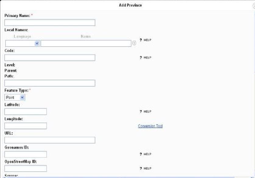
- Click "Add Province" will go to the page.
- Fill in the information of the location and primary name is required.
- Use "Conversion Tool" to have the coordinate info from your GPS fit the formate of Sahana Eden .
- In GPS format, fill in "deg" and "min" from GPS and click "calculate" button to have the decimal degrees.
- Click " Fill in Latitude" if that is it, same for longitude.
- Click save and the screen will go back to the incident reporting page. The location you just add will be the location of the incident.
4.Report confirmed incidents
- A confirmation message will be shown.
- Without Confirmation, information will not be saved.
Flow Graph
Report
- The list of Incidents,People affected,Reporter Name and detail of disaster can be export to files, such as: PDF, Excel, RSS
- But they are just the summary of informations.
6.Images
Getting Started
Add Incident Report
List Incident Report: Fill the Details
Add Province
Add Person
Video Tour
INTRODUCTION to INCIDENT REPORTING
Attachments (8)
- IR Flowgraph.JPG (24.7 KB ) - added by 15 years ago.
- IR4.JPG (26.9 KB ) - added by 15 years ago.
- IR5.JPG (58.5 KB ) - added by 15 years ago.
- Sahana Eden workflow.docx (13.2 KB ) - added by 15 years ago.
- Sahana Eden Incidence Reporting kush8975.flv (6.3 MB ) - added by 15 years ago.
- IR1.JPG (80.4 KB ) - added by 15 years ago.
- IR2.JPG (95.4 KB ) - added by 15 years ago.
- IR3.JPG (53.3 KB ) - added by 15 years ago.
Note:
See TracWiki
for help on using the wiki.

