| Version 51 (modified by , 12 years ago) ( diff ) |
|---|
Introduction
The idea is to create a website that informs the public
of available disaster shelters. Hopefully, this will
benefit those who are left temporarily or permanently
homeless in the aftermath of a disaster.
Description
- Website allows users and shelter administrators to register
- Users can log on and view shelter information
- Shelter administrators can log on and edit their shelter's information (address, capacity, current enrollment)
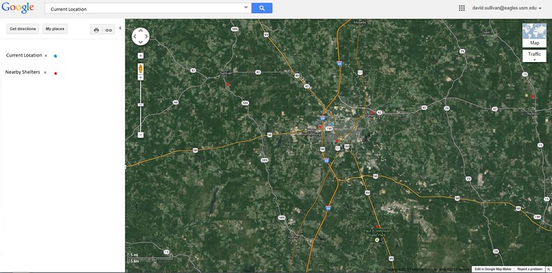
- Users can find closest shelter to their home address (Google Maps Implementation)
- Website will send alerts to registered users during emergencies
- Users can register for volunteer work
- Volunteer work can include surveying people staying in shelters (satisfaction, food quality, sleeping environment, etc.)
- Volunteer survey information can then be displayed to public via website
- Users can donate on website
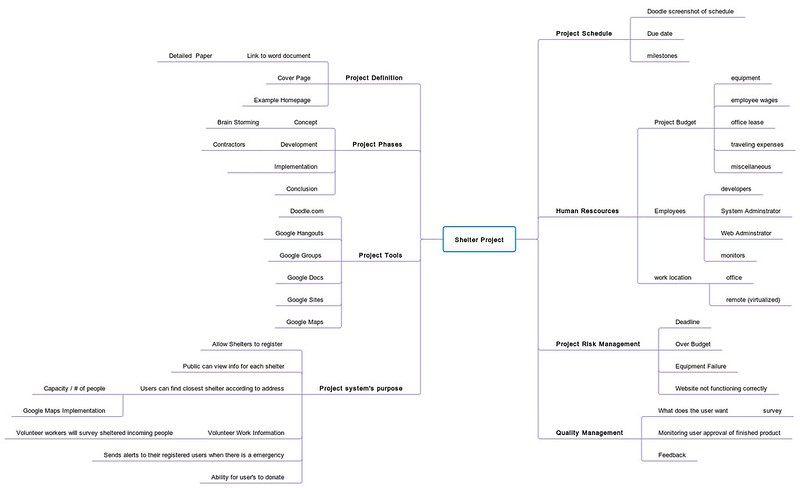
Mind Map Link: http://mind42.com/mindmap/e2981e7d-b07d-45c2-81ab-7ad9d5270b22
Requirements
- Website should allow creation of two types of accounts (User and Shelter)
- Users should be able to log on and view available shelters
- Shelter Administrators should be able to log on and post information about their shelter (Address, Capacity, Current Enrollment)
- Google Maps should be integrated to show available shelters relative to user's home address
- Users should be able to register for volunteer work on website
User Cases
- Example of a public user:
- Users creates an account and logs on to website
- User can now view available disaster shelters
- User can also view information about shelters (address, capacity, current enrollment)
- User can use Google Maps tool to enter their home address and fine closest shelters to them
- Google Maps can also provide driving directions for the user
- User can choose to register for volunteer work
- User can choose to donate on website
- Example of a Shelter Administrator (Owner, Operator, etc.):
- Admin creates an account and logs on to website
- Admin can edit information about their shelter (address, capacity, current enrollment)
- Admin can post announcements about their shelter to the public
Design
Website Mockup:
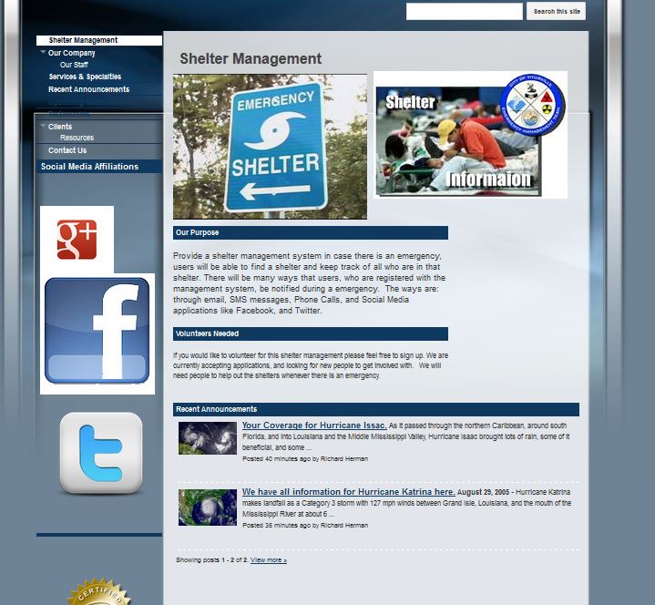
Google Maps Implementation Mockup:
Timetable
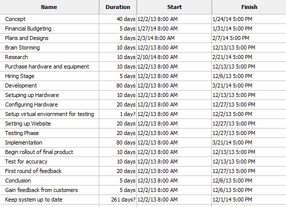
Timetable
Note:
See TracWiki
for help on using the wiki.

